Tuesday, May 29, 2018

Mount Mazama

Leaving for Boring, OR today
We have planned our route through Washington, Montana, Idaho, Wyoming and Colorado through mid August

In between a day of rain and visiting the Rogue River, we visited Crater Lake National Park two times.  The first day, the road was only open to Discovery Point, just beyond the Rim Village and Lodge.  But by Memorial Day weekend the road around 1/3 of the Lake was open.  The rest of the road is still being plowed!
No hiking trails were open nor was the boat that cruises the Lake operating just yet.  Bummer.

As I mentioned in the previous blog, Mount Mazama erupted about 7700 years ago.  Then the peak collapsed and created a basin (also called a caldera).  Centuries of rain and snow filled the basin to create the deepest lake in the United States - 1943' deep.   The blue color and clarity are spectacular.  My photos can't capture the beauty here.  The clouds are reflected in the Lake!
As you can see, there is still a lot of snow here!
I tried to capture the clarity of the Lake, along with the green hue it takes close to the shoreline.
I love this photo from Merriam Point that shows the north sides of the caldera and all the snow that remains.  That peak in the middle is called Wizard Island and is a cone left from the volcano.

Llao Rock was formed when a lava flow filled a crater on the north side of Mount Mazama.  When the mountain collapsed part of the hardened lava flow cracked and dropped inside, while the remaining part was left on the rim.
Looking away from the Lake on a clear day, we saw three other volcanoes - Mount Shasta (the one we saw on our way to Redding over 100 miles away) as well as Mount McLoughlin (on left) and Union Peak. They are all part of the Cascade Mountain Range.  I couldn't get a good shot of Shasta, although we could see it clearly.
 I thought it was interesting that Johnny was wearing shorts and a tshirt with so much snow around!
We took the opportunity to see the Crater Lodge ( built in 1915)as that is one of my favorite stops in the National Parks!  This one is very cozy.


One of the most beautiful vistas yet.

Monday, May 28, 2018

Wild and Scenic River

Currently In: Prospect, OR
Leaving for Boring, OR outside of Portland tomorrow
We will be in Washington next week and then the tour of National Parks begins


First and foremost, hoping that all of you had a wonderful Memorial Day and took the time to remember those that fought and died for our freedom.  Other than a few Christmas decorations, these 3 little flags were the only other holiday items I brought from Elm Street.  Proud to be able to put them outside our rig today.

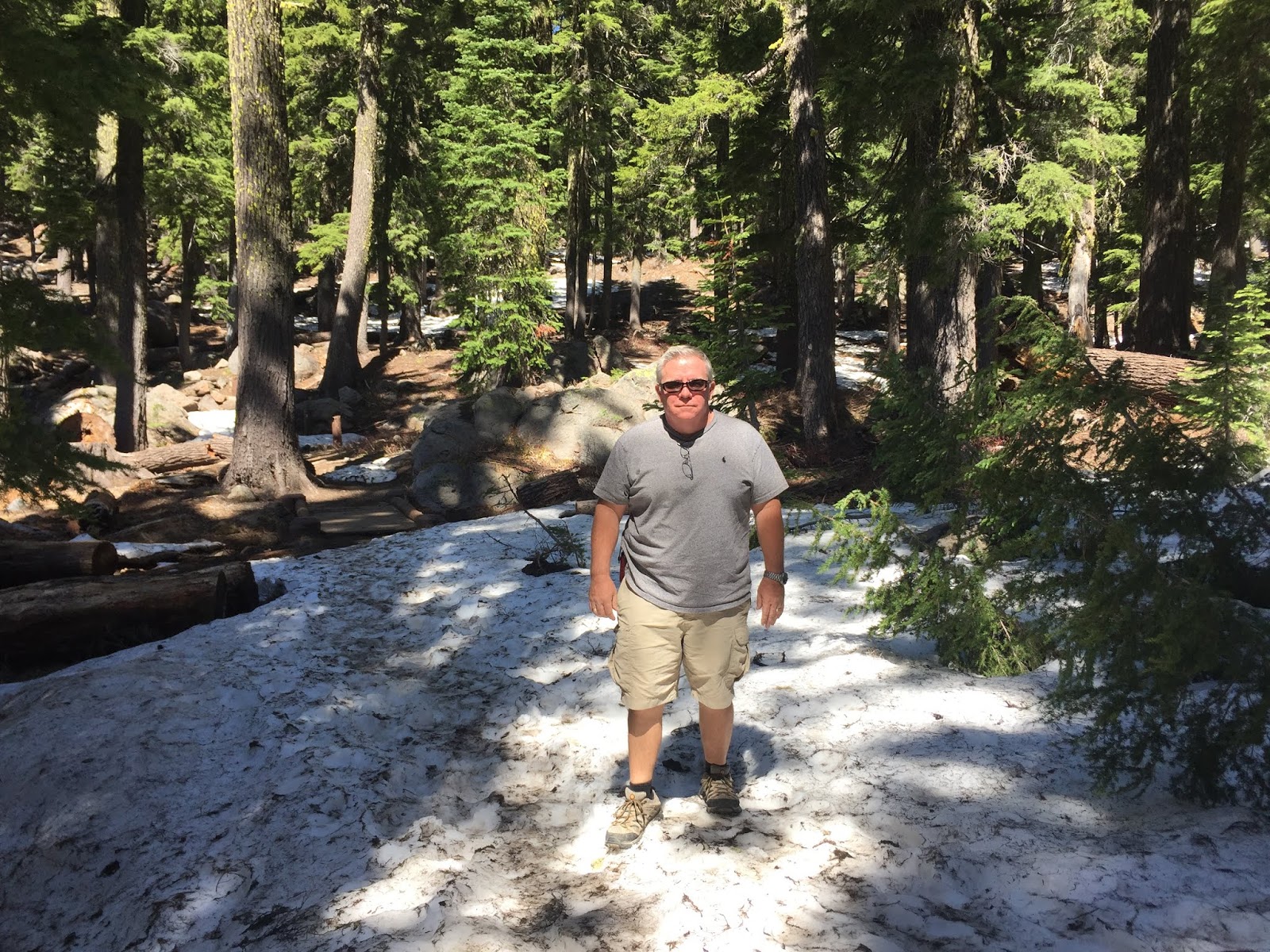
Johnny and I spent a lot of time visiting the beauty of the Rogue River while in Prospect.  Because of its beauty and free flowing character, the Rogue was named a Wild and Scenic River by Congress in 1988.

The River was created by the eruption of Mount Mazama along with subsequent snow and rain some 7700 years ago.  The spread of the lava helped develop the waterfalls, gorges and other natural occurrences.  The River fills up each year as snow melts from the higher elevations.

Avenue of the Boulders

Avenue of the Boulders
Then the waterfalls..

Mill Creek Falls - 173 feet long

Barr Creek Falls - 242 feet long

Pearsony Falls
Here are a couple of pictures from the Pearsony Falls trails that I just thought were pretty.

Then we hiked a couple of trails a bit north of our campground.  On the Natural Bridge trail, the Rogue River flows in and out of lava tubes created by the volcano- they look like caves.  Part of the River is hidden underground.

At this point, the River is flowing underneath this section of hardened lava - thus it's called a Natural Bridge.  You can see the River at the bottom of the photo and then I got just a small bit at the top where it is past the bridge.
Finally we saw the Rogue Gorge.  The River is moving very fast through this small canyon.
We were also able to take a quick run up Flounce Rock which is just south of our RV park.  We drove up about 4 miles to get to the top and saw some wonderful views of the mountains, the National Park, the River and Lost Creek Lake.   We could also see Medford which is about 30 miles south.
Here is a shot of Mount Shasta (about 100 miles away) from a distance.  It is just huge.
And this shot of Lost Creek Lake is pretty from a distance.  It runs right into the river.


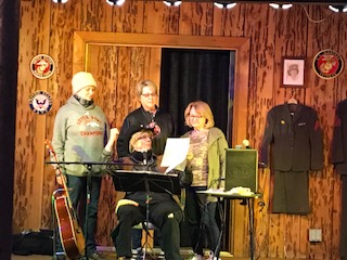
On a last note about Memorial Day, our RV park had a celebration on Saturday evening.  There was a folk singer, bonfire and some snacks.  What else do you need?


This is the biggest marshmallow I have ever seen!  Roasted perfectly by yours truly.

The park owner told a couple of stories about her parents' experience in the Armed Forces.  It was very sweet.  Then she and some friends sang barbershop quartet.  You never know what you're going to run into out on the road!


Thursday, May 24, 2018

You win some, you lose some

Currently In: Prospect, OR near Crater Lake National Park (It's beautiful here!)
Next up:  Several National Parks and then Colorado in July


Our last day in the Redwoods National Park started with a win -sunshine!  It was foggy/cloudy for most of the other days we were in the area.

We wanted to visit Enderts Beach at low tide so we could see all the wildlife in the tide pools.  Our first loss - the trail was closed due to rock slides.

Instead we took a walk along black sanded Crescent Beach.  It was glorious!

Our plan was to hike the Fern Canyon Trail in Prairie Creek Redwood State Park.  This State Park is considered part of the National Park.  We found out at the Visitor Center a few days earlier that the gate to the trail is still locked because it is early in the season and they were preparing the road.  So we were told to park at the Gold Bluffs Campground and walk two miles to the trailhead.

We arrived at the entrance to the State Park and another win! The gate to Fern Canyon had just opened that day.  We could drive right to the trailhead.  Good news to middle age folks whose knees don't last forever.

We knew the trail might have a few wet areas.  Some folks who had hiked out said it wasn't too bad so we took our chances wearing sneakers and carrying our water shoes in the backpack.
We made it across the first big puddle.
 Around the corner was this.  Beautiful. (Those are ferns growing along the sides of the canyon.)

And one big long river.  So, out come the water shoes.

This was unlike any hike we had done before - and we've done our fair share of hiking if you have been following this blog at all.

The canyon,


The water,

And the challenging path were a definite win.
I tried to get a close up of the ferns along the canyon wall because it's so unusual.  By the way, Steven Spielberg liked the canyon so much, he put it in Jurassic Park II.
Hike complete!  But somebody thought his shoes were waterproof.  Too bad his socks were not!  I guess this was a loss.
On our way back to the RV park we had a win and a loss.  And they were both the same thing.  We saw another gang of elk.  One female was crossing the road. Maybe her calf was on the other side.  She was magnificent!
Unfortunately, some other tourists decided to get out of their cars and move toward her to get a better photo.  She got skittish and lunged forward to ward them off.  One person got back in her car but the others didn't move!  They were finally told by you-know-who to get back in their cars so they wouldn't get hurt.  I felt sorry for the poor elk who was stressed by all the activity.
Our adventure has given us a renewed sense of Nature and all that She shares with us.  We try to respect and enjoy.


Tuesday, May 22, 2018

Eureka!

Currently In: Crescent City
Leaving for Crater Lake National Park today


We took a drive down Highway 101 to the cute town of Eureka, CA.  I love the historic towns all over the US, but we have visited so many that were in disrepair.  It was great to see one that was thriving!
Cafe Waterfront is a good example of Queen Anne architecture.  Originally the two story Weaver Building housed a saloon on the ground floor and supported a brothel upstairs.  Later it was the Bluebird Cabaret charging a dime a dance.  Today it has a delicious brunch. 

There was jazz music with our lunch.  So relaxing.
We tried the Oyster Shooters.  Cheers!
We took a walk along the harbor and saw this fishing boat returning to the harbor.


Next we walked through the historic part of Old Eureka.  It was very cute.

We stopped to see the wooden sculpture garden of Romano Gabriel.  Between 1915 and 1967 he made these wooden pieces that eventually covered his entire front yard and attracted tourists.  I tried to take a close up to highlight how unique his art is. 


We took a drive through the neighborhood of Victorian Homes.  The Carson mansion is the largest and most intricate.  It is now a private club.
This is the Carson House.  It fell into disrepair until it was purchased and restored in the 1960s.  It is now known as the "Pink Lady".
This beautiful yellow house in now a bed and breakfast.

Our RV park was not in Eureka, but in Crescent City.  Here is the view of Crescent Harbor right in front of our rig.  Typically lots of fog.

Crescent City is known for a couple of things - lighthouses and the tsunami that hit in 1964.  The tsunami devastated the city, so the houses and other buildings are from the late 1960's and beyond.  There are posted signs all over town telling people to move to high ground in case of tsunami.  And others like this.
The lighthouses are much more interesting.  We can see the Battery Point Lighthouse from our RV site.  It is one of the first lighthouses on the California Coast dating back to 1856.  I love this shot at dusk.
You can only go visit this particular lighthouse at low tide because you have to cross the harbor  and then walk the road.  Here is the path at high and low tide.

Once you make it up the road you are treated to some cool sea art.
Gray whale

Old Fisherman
We took a tour of the lighthouse, but I was not allowed to take any photos inside the keeper's quarters.  The docent told us many interesting stories! The last keeper left in 1953 although the lighthouse is still operational and run by the Coastguard.  There are volunteers who stay at the lighthouse just to make sure the automatic halogen light does not ever go out.

The other lighthouse in Crescent City is called St. George Reef Lighthouse.  It is 6 miles offshore and barely visible from the lookout point.  They only do 4 tours a year and you have to take a helicopter to get there.  It is $300 per person.

The view along St. George Point is spectacular and the cliffs remind me a bit of Ireland.
While we were at the Battery Point Lighthouse I saw a likeness of the one at St. George Reef.  The lighthouse was operational from 1892 until 1975.  It was the worst keeper assignment to have since it was so far away from shore.
Final note about Crescent City and cities along the  Northern California Coast.  The rhododendron are in full bloom.   Here is an example, but I have seen different shapes and sizes and some variation in color.  Gorgeous, simply gorgeous!