Phoenix, AZ
Heading to Tucson next week
Last Friday the sun was shining and it was relatively warm, so we took a drive along the old Apache Trail. The road is named for the Native American tribe (and potentially other ancients) that used this path to go into the mountains in summer (cooler) and down again in winter (warmer). It's a scenic drive with some elevation and switchbacks which made it fun!
The Trail runs through the beautiful Superstition Mountains.
We first stopped at the Superstition Mountain Museum and learned so much about the history of this area from prehistoric times through the use of the road as a stagecoach trail and finally to frontier settlement near the Salt River. Eventually, the Roosevelt Dam was completed in 1911 to enhance irrigation to the area and spur population growth.
Near the Apache trail was a movie set called Apacheland where many movies were filmed. Although much of it burned by fire in 2004, some of the set pieces were moved to the museum. Among them, this Elvis chapel. Kind of random.
Like so many communities in the west, another part of history in this area is mining. There was an extensive display in the museum about Jacob Waltz, known as the Lost Dutchman. He told some neighbors about a gold mine he discovered in the Superstition Mountains, but then died before he was able to recover any gold. The stories around the mine are varied and confusing, but some still believe in a hidden gold mine.
The Stamp Mill below from 1914, crushed ore that contained precious metals. This mill is originally from Bland, NM and was moved to the museum in 1988. It weighs about 70 tons. Huge!
This model railroad display was a pleasant surprise. It depicts scenes from the local area - mines, the dam, and a frontier town.
We could have spent hours at the museum, but I was excited to get on the scenic drive! Next stop was the old mining town of Goldfield. It was supposed to be a ghost town, but really was a big tourist town. We only spent a few minutes looking around to see if there was anything of interest. Some of the building were kind of cool, but my sense is that many were built after the town had attracted so many tourists.
Now for the scenic part of the day! First we stopped at a turnout where we could see Weavers Needle in the distance, a rock column 4,555 feet tall. It was created by eroding volcanic ash.
Just after that was the lovely Canyon Lake. The lake was created when the Salt River was dammed in 1925. The blue water in the mountains on this sunny day was so peaceful.
We crossed many single lane bridges on the trail. Not too much traffic, so there were no issues.
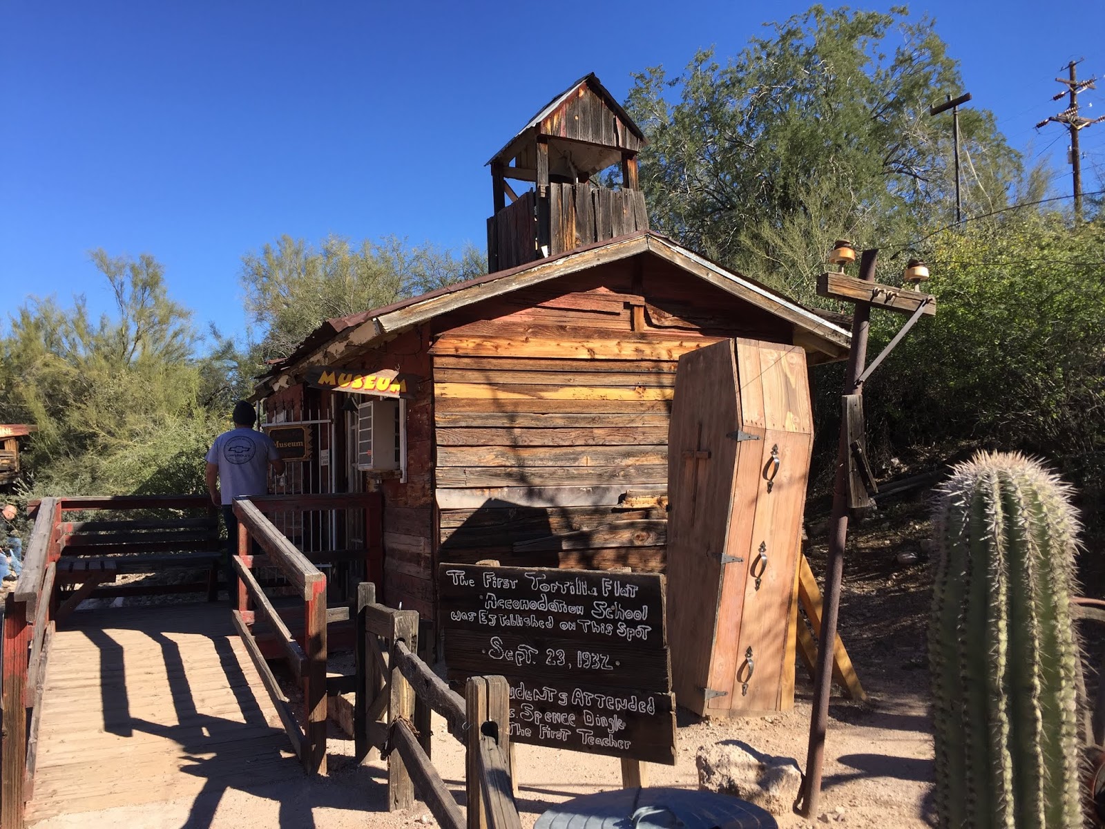
The road led us to Tortilla Flat, the last surviving water and supply stop on the old stagecoach trail. Now it's just a strip of storefronts - restaurants and gift shops. We looked around for a bit.
We walked down to check out the museum which was housed in the first schoolhouse built in 1932.
Let's just stop for a quick refreshment while we listen to the band on the patio.
Back on the trail, the paved road ended and we were off roading in the Red Jeep once again. I read reviews online that the drive was treacherous including big drop offs, but we didn't fine it too bad.
The landscape was so unusual up here. Moss creates the green hue on the mountains.
There was ice and snow along the parts of the mountains that don't see the sun.
We drove around the bend and through an interesting rock formations.
So pretty here.
Fish Creek had another one lane bridge. We were at the low point here and could look up at the mountains.
Once out of Fish Creek we drove through more of the Tonto National Forest. The saguaro are crazy up here!
That's snow at the top of those mountains!
Apache Lake was in the distance. It was also formed by a dam and is used as a recreation area with boating, fishing, swimming along with restaurants and hotels. The canyon walls are so cool. This lake looks more like a river as it is 18 miles long and just a few hundred feet wide.
Just beyond Apache Lake is Roosevelt Dam. Construction of the Dam began in 1905 and was completed in 1911. The Apache Trail was created to enable supplies and people to easily move back and forth from Dam. The height of the Dam was raised to 77 feet in 1996. It took 9 years to complete these modifications!
The beautiful Roosevelt Bridge was a nice surprise at the end of the Trail. It stretches over Roosevelt Lake - they like that Roosevelt name don't they? The bridge had to be built before the update to the Dam in order to reroute traffic. It is the longest (get ready for this!) 2 lane, single-span, steel-arch bridge in North America.
It took us about 4 hours to drive through the Mountains on the Apache Trail, so we took the highway home instead of retracing our steps. The drive was lovely as we saw snow everywhere!


No comments:
Post a Comment